A Blog of Flashbacks Oregon Is Burning
September 2020
Oregon is burning. Of the twenty-four stations across the state reporting air yesterday, Lakeview had the best in the morning at 129, Unhealthy for Sensitive Groups. At least one town in the state is 501, Hazardous. The air quality indices go from good—moderate—unhealthy for sensitive groups—unhealthy—very unhealthy—to hazardous. Most of the state’s air is hazardous. This afternoon Lakeview’s air quality is 154—unhealthy. Winds come from all directions in the past month or more.
Eugene’s air quality is 456 yesterday morning. I used to live in Eugene and its surrounding areas. I lived there during the Oxbow Fire in late August 1966. The BLM (Bureau of Land Management) news release in 2011 said it was the first wildfire ever brought under control without the help of a weather event such as rain and no wind. My hat is off to firefighters of 1966 and every day between then and today. Oxbow had stretched for over 15 miles in length and seven miles in width. It occurred closer to Eugene than I realized—20 miles to the southwest. In those days, the sun rose red at 10:00 a.m., remained red, and set red at 2:00 in the afternoon. So dark was the sky with smoke, the rest of the day we had no sun, only dusk or night. That was only one bad fire. Now we have many at once.
After Eugene I lived in Leaburg to the east on the McKenzie River, then moved to Lorane, a town to the west of Eugene. I lived in forests. My greatest fear in Leaburg was the McKenzie River flooding since I lived 20 to 30 feet from the river depending on snow runoff. I awoke one morning to the sound of waves. Leaping out of bed, I saw two-inch waves lapping against the cabin wall beneath my window. My cabin had survived a 100-year flood four years earlier. I was not worried.
I don’t know whether the cabin survived this fire. There is no one I can ask for Leaburg had a Level 3 evacuation order. As far as I can tell, it is the westernmost edge of the Holiday Farm fire. It made me feel secure to know Leaburg was a staging area for fire and person aid. Maybe I should say “was” because Walterville and Marcola to the west have now evacuated also. The Holiday Farm fire along the McKenzie River and Highway has burned over 165,000 acres and is 6% contained.
We’d been out camping in the desert. As soon as we got home and heard Leaburg was a Level 3 evacuation, I called Ella Mae, my son’s babysitter. True, he just turned 50, but Ella Mae was a lifeline. I remember showing up one day after work, dog-tired and just wanted to collect my baby and go home. Nope, she said, you sit down and eat first.
Ella Mae, I wailed.
If you go home now, you go home alone.
Of course, I wasn’t going to do that! I sat down and ate. Hamburger wrapped in cabbage rolls. How could I not stay in touch with someone so good to me? I cried before I called. She’s fine and so are her children, Kathy and Raymond and her grandchildren. I asked her where she was. Trauma can be so controlling, she had to turn to ask Kathy. They had evacuated to Junction City. They’re fine. All I really needed to hear was just her voice. I cried after we hung up. Then I could cry for my long ago left cabin. Every time we pass through Leaburg, my husband and I stopped to see Ella Mae and to visit the now-empty cabin. Memories stay, but the fir-covered mountains across the river are probably now covered with trunks of blackened needleless tree trunks spaced apart as many trees have burned up or fallen. What a different view it would be. That view of the river, island, and tall Douglas fir forested hillsides opposite.
I ache. What shall I take if the fire were that close to us for an immediate evacuation? I look around at much original artwork, oriental carpets, the loveseat my father proposed to my mother on, and as Robert says, the one he proposed to me as we lay on the floor in front of it, my journals from when I was a child to today, photo albums from my life and before it began, all my standard celeration charts from 1967 on.
No. It will be the candle my great-uncle found in 1873 on Batts Beach in Barbados when he was 13 and on a trip with his father, captain of the ship. It will be my computer, iPad, and cell phone—my working tools. I’ll also take one small Oriental rug from my study here. I have the perfect place for it in my studio in Alaska.
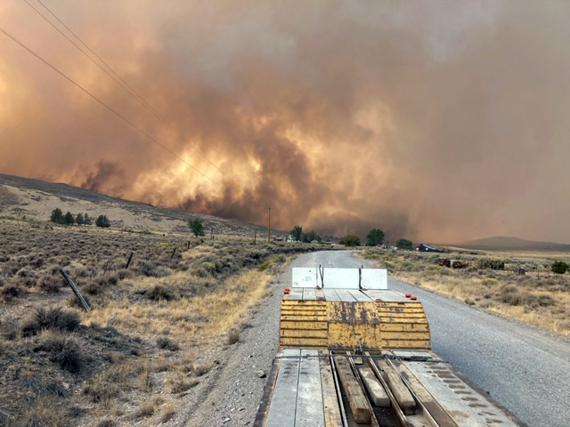
Yesterday and today I look at smoke trying to block Black Cap as I sit here at my computer. The Internet says the winds are blowing from the south at 16 mph. There is the Brattain Fire, south of Paisley, 30 miles north from us. 30,000 acres and 0% contained.
 |
Brattain Fire. Dennis O’Leary took the photo from Clover Flat Road looking north toward Paisley. |
Dennis and Maureen’s mother, the former Marie Cray, was my husband’s second grade teacher. So lovely was she, my husband decided he was going to marry her when he grew up. She married an O’Leary. Her daughter, Maureen, lives not far from us in the Far North. She and one of the Brattain family are good friends. The older Brattain sister was one of the first people Robert had contact with when he came back from Vietnam. Their brother was in the Marines with a friend of mine. You don’t have to follow all that! My point is that it truly is a small world we live in. That we are all interconnected is what we need to remember. In the 55 years I’ve been related to Oregon and paid property taxes here, it’s always been a pretty divided state, but then I read that people from Detroit, Blue River, Phoenix, Talent were all helping one another. Politics is immaterial in disaster be it COVID-19, BLM (Black Lives Matter), raging wildfires that can give you a Level 3 evacuation notice in minutes or burn your house and all its contents to the ground in minutes. We are all in this together and we must work together.
Yes, uncontrolled fires and all of the above can cause trauma. And will.
 |
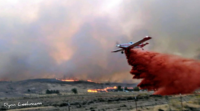
Brattain Fire. Ryon Leehmann took this photo of the Brattain Fire in the background, the back burn in front, and the plane dropping fire retardant. |
 |
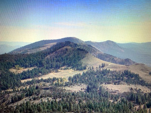
View from Morgan Butte from a hike I took in 2006. Haze is from LA area fires, over 700 miles away, yet I could smell the smoke. Morgan Butte is so close to Brattain Ridge that this month’s Brattain Fire may have burned this area also. |
If you look at a fire map of the USA, you can see we have fires on the West Coast from the Mexico to the Canada borders. It is a solid red line between the ocean and the mountains. And still more fires burn east of the mountains.
To escape the smoke from a different fire over a month ago, Robert and I journeyed north two weekends to Christmas Valley. We viewed the volcanic wonders of the area. Their air is now worse than ours.
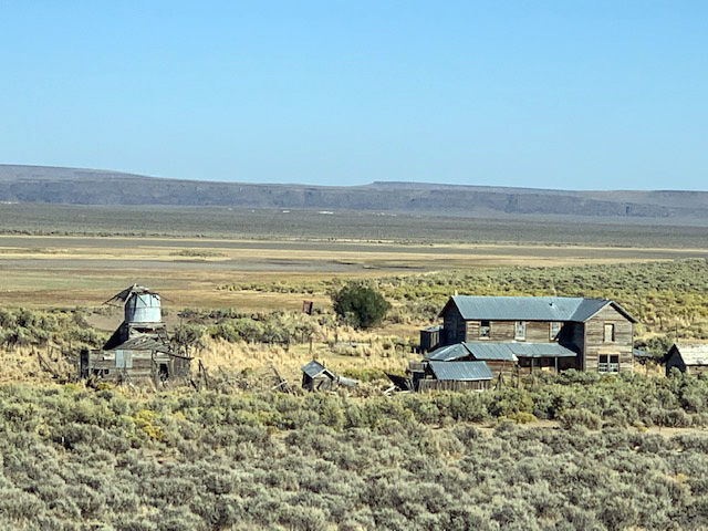
Two days ago, we headed east to the former family Barry Ranch in Guano Valley, now ranched by a variety of cousins. We wandered the Barry house and Shirk Ranch and found peace of mind. To go there is to go back to his childhood memories of Guano. For me, it is a place I wish to live, twenty or more miles from the nearest neighbor, twelve miles from the paved road. Quiet, a night sky full of stars, land of sagebrush, empty and quiet enough to fill my soul, a soul that needs peace and calm these days.
 |
The Shirk Ranch in Guano Valley. |

|
